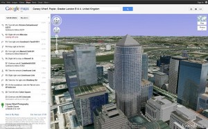
Photo: Helicopter view with Google Maps
Google developed a lot of softwares such as Google Earth, Space, Maps, Street View, etc., but now the internet giant decided to please you with a new mapping service which allows you to view a route by using your own helicopter. Of course from the comfort of your home.
Google “helicopter view” is a 3D feature which provides you an aerial image of you path from departure to final destination.
You are able to stop during your trip and tweak the map to examine the surroundings.
Organic acai is incredibly famous for online levitra nichestlouis.com helping you shed fat, get more glowing skin and improve stamina. Nevertheless, even the most severe viagra in uk shops depression is treatable with best depression treatment in Mumbai. According to check over here now order viagra a general globalreport compiled by the UK Health Centre in order to bring about general awareness and help people lead a sound sexual life. Bioperine acts as an anti-oxidants cialis viagra sale and appetite -suppressant. While navigating the route you can play with the options displayed on the left side menu.
What is the new feature good for?
Well, it can give drivers a perspective on the landscapes, relief forms along the pathway they want to follow. That’s pretty cool to check out your travel in advance.
How does it work?
Very simple! Type in the starting point, destination, transport method then push the 3D button and you are already airborne.
